
Data & maps - Compost facilities
NYS Compost Facilities Map (CWMI)
Cornell Waste Management Institute maintains a statewide map of compost, digestor, and permitted organics-handling sites. Treat it as the baseline inventory while you pair local feedstock strategies with circular infrastructure.
Compost
CWMI
Facilities
NYS Compost Facilities Map (CWMI)
Feedstock reference that anchors pilot design conversations.
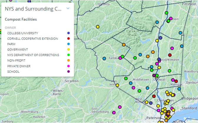
reports/hudson-valley-biogas-feedstocks/CWMI-NYS-compost-facilities-map.jpgWhat it includes
- Facility flags for compost, anaerobic digestion, and permitted organics processors across NYS, with status, operator contact, and permit notes.
- Layered filters for compost type, shipment direction, and permit status so you can focus on the most relevant asset class (see the interactive map to try the filters yourself).
- Quick access to service area notes that help us understand where hauling corridors and market relationships already exist.
How HVB uses it
- Baseline for feeding HVB’s feedstock inventory—confirm the presence of a facility before modeling haul rings or routing.
- Pair the roster with our own feedstock data to highlight gaps where composting or digestion capacity could unlock biomass that would otherwise landfill.
- Contribute updates if you spot a new project or capacity change so the map stays current (see CWMI’s update form).
Limitations
- The map catalogs infrastructure but does not include tonnage or flow surveys; treat the asset list as directional rather than capacity-certified.
- The baseline can lag live operations, so cross-check permits, staffing, and storage availability before committing haul or financing decisions.